There is a particular allure to the United States that persists regardless of how many times its icons have been seen on screen. Growing up on films and television gives you a strange, secondhand familiarity with places you have never visited — Rodeo Drive, the Golden Gate Bridge, the open desert roads of countless Westerns. Arriving in person does not dispel that familiarity so much as complicate it, layering a first genuine experience on top of a lifetime of borrowed images.
This was a trip built around distance and variety: two weeks and roughly the length of a continent, moving from the Pacific coast through desert, mountain, and canyon country, with two daughters in the back seat measuring the journey in giant sequoias, elephant seals, and the occasional flash flood warning. It followed our trip to Namibia, a very different kind of journey and, in its own way, just as hard to top. But the comparison never really mattered. Each place asked to be taken on its own terms, and the American Southwest had more than enough of its own to offer.
The route
- 1 Los Angeles
- 2 Santa Barbara
- 3 Los Osos
- 4 Piedras Blancas
- 5 San Francisco
- 6 Mariposa Grove
- 7 Yosemite Valley
- 8 June Lake
- 9 Alabama Hills
- 10 Death Valley — Mesquite Flat
- 11 Zabriskie Point
- 12 Las Vegas
- 13 Zion National Park
- 14 Kanab
- 15 Bryce Canyon
- 16 Lower Antelope Canyon
- 17 Horseshoe Bend
- 18 Monument Valley
- 19 Williams
- 20 Grand Canyon South Rim
- 21 Joshua Tree (approach only)
- 22 Palm Springs
- ↩ Los Angeles (return)
Day by day
Los Angeles & Santa Barbara — Day 1
The trip began with the particular fatigue of long-haul travel. After landing in Los Angeles, we collected the car and drove north to Santa Barbara for dinner by the beach — a gentler introduction to the coast than Los Angeles itself. Jet lag, however, had its own agenda: the ocean view was there, but none of us were quite present for it. We spent the night near the airport before the real journey began the next morning.
Rodeo Drive & the coast to Los Osos — Day 2
The morning began with a walk along Rodeo Drive — an obligatory stop, more cultural landmark than personal interest, but the kind of place that carries a particular weight for anyone who grew up on films and television from the nineties.
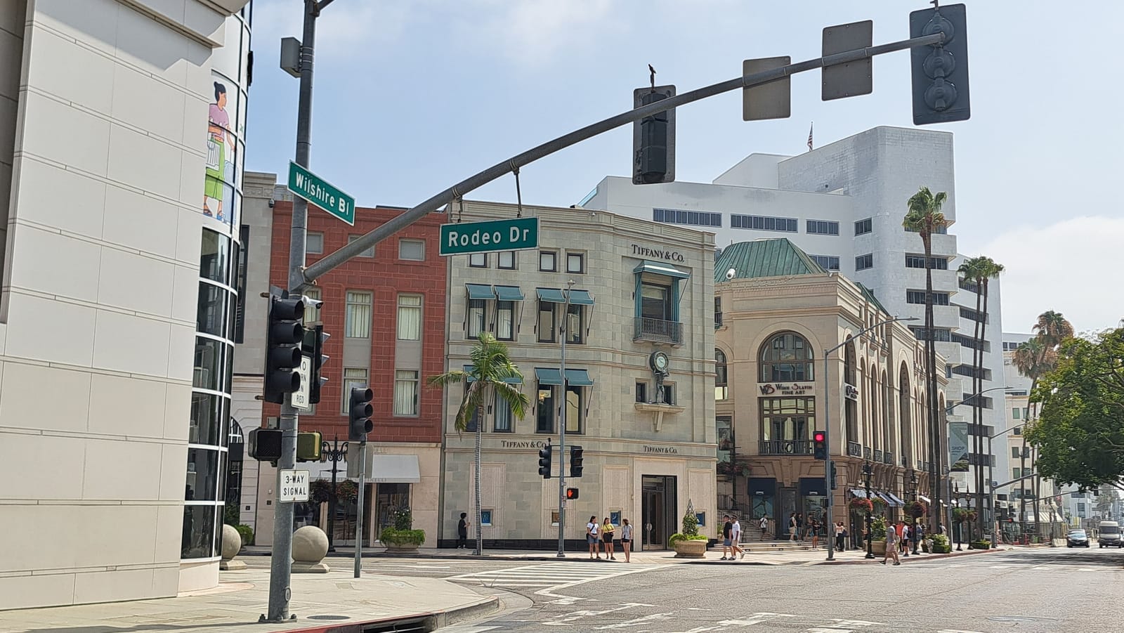
From there, the day turned toward the coast. Heading north out of Los Angeles, the route hugged the Pacific — rugged headlands, sea stacks, and cliffs dropping straight into the water, a version of the California coastline that owes nothing to the city just left behind. A stop along the way brought us to a stretch of shoreline where the erosion has carved the sandstone into arches and freestanding towers.
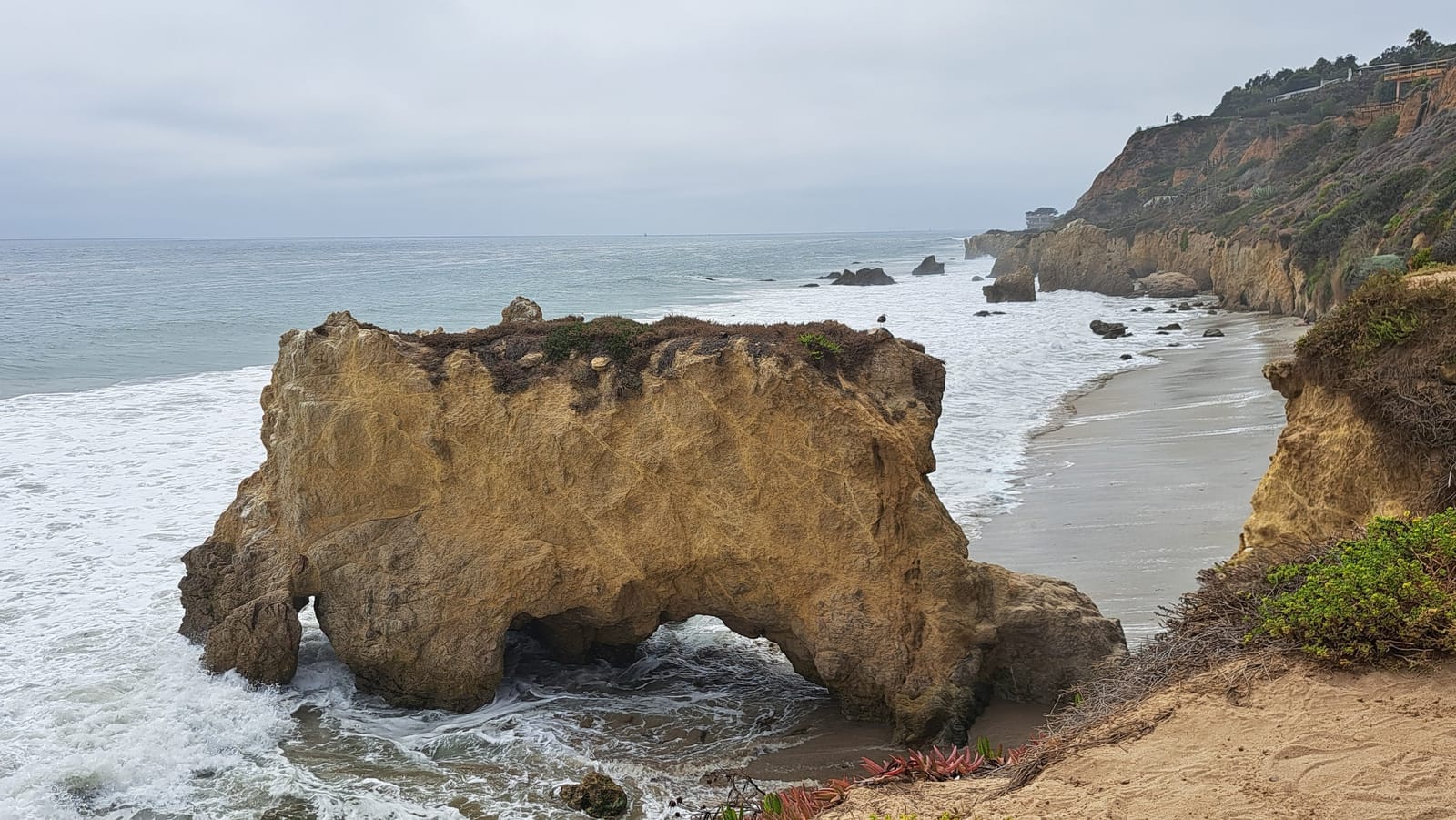
The drive continued north past Morro Bay, and we spent the night in Los Osos — a quiet landing point after the density of the morning, with little to do but settle in before the next stretch north.
Piedras Blancas, Highway 101, and San Francisco — Day 3
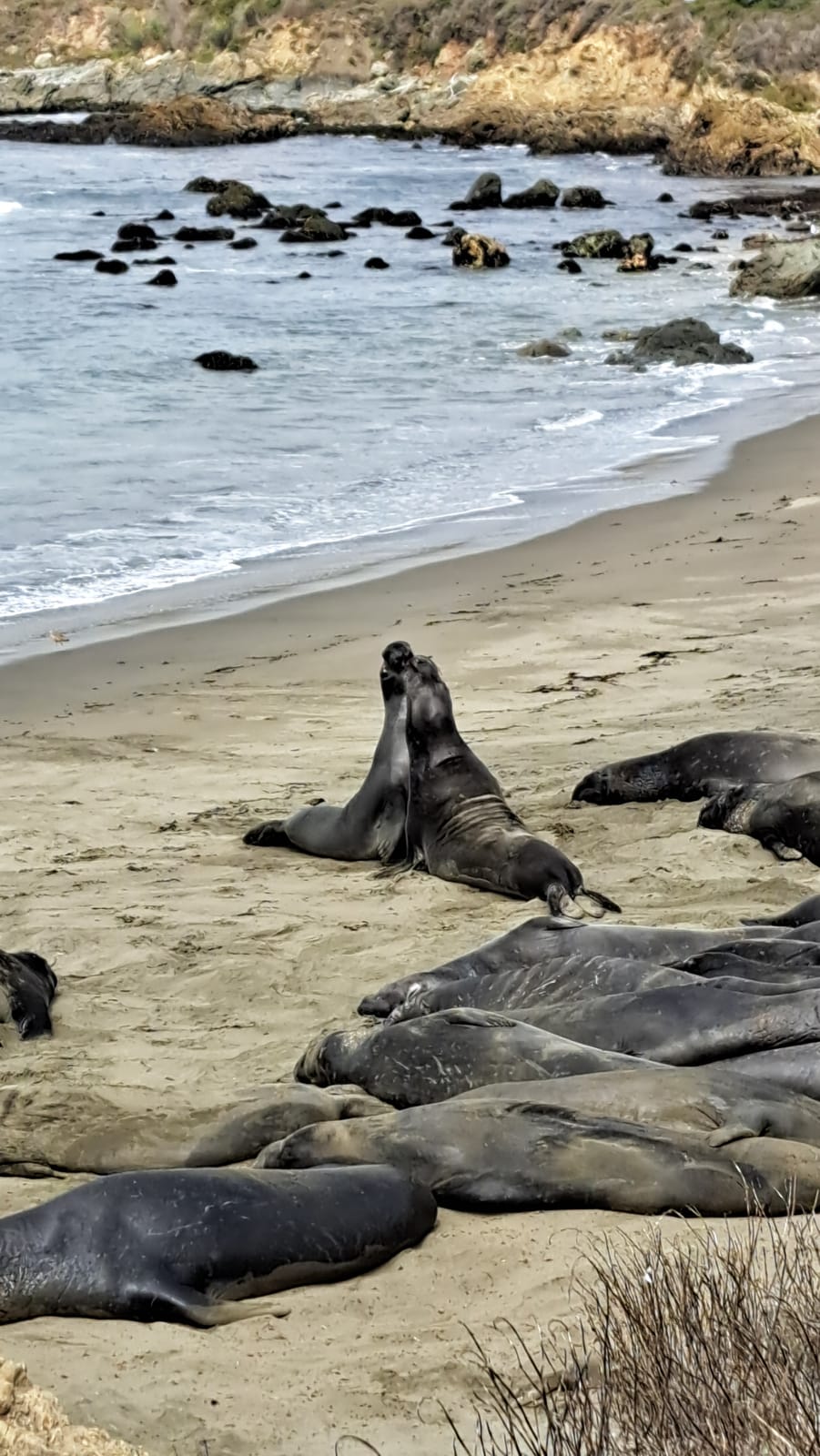
The day began under a low mist, the fog not yet burned off as we continued north toward Piedras Blancas to see the local elephant seal colony. Dozens of animals lay scattered across the beach. In August, most of the colony is out at sea. The show must be even grander in other seasons. Every so often two males would rear up against each other, necks arched and mouths open, in a brief and noisy contest before settling back into the sand as if nothing had happened. It is a strange, faintly prehistoric spectacle, and well worth the stop.
The plan had been to continue north along the Pacific Coast Highway, but the road was closed further ahead, forcing a detour inland onto Highway 101 for the remainder of the drive to San Francisco. It was a more efficient route, if a less scenic one, and we arrived in the city by mid-afternoon.
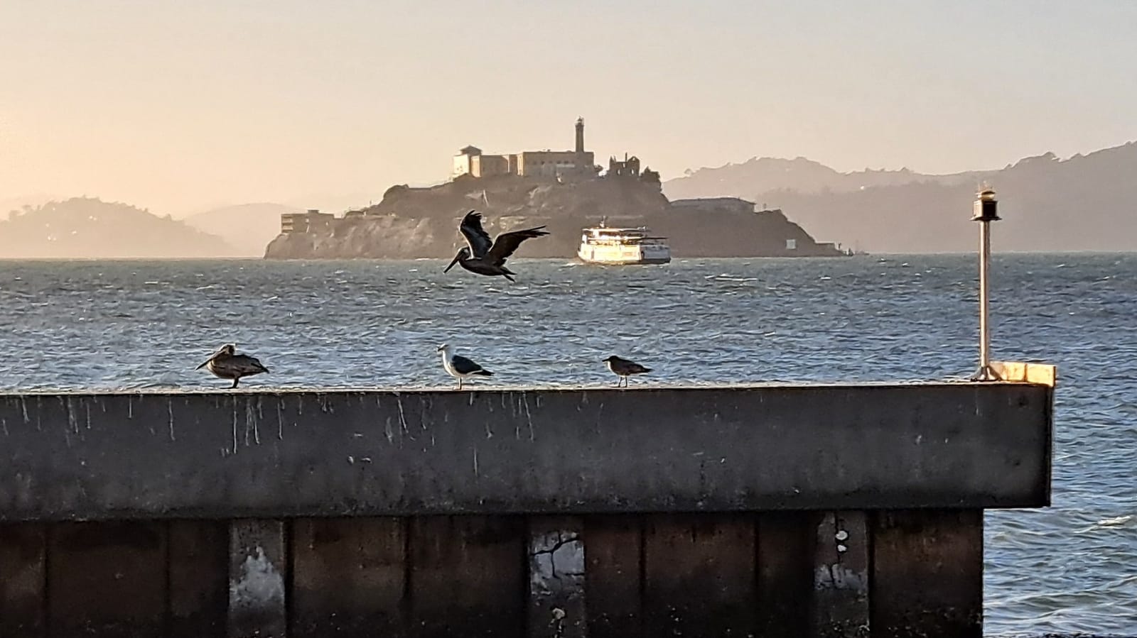
We spent the evening around Fisherman's Wharf, walking the waterfront before dinner. San Francisco has a reputation for fog and rain more often than not, which made the clear skies at sunset feel like a small stroke of luck, Alcatraz visible across the bay in the last light.
Alcatraz, the Golden Gate Bridge, and the cable cars — Day 4
The good weather held into a second day, sunny again after the previous evening's rare clear sunset. The morning was dedicated to Alcatraz — the ferry crossing, the cellhouse audio tour, the sense of isolation that the island still carries despite the crowds. Of everything in San Francisco, this was the stop that resonated most with our daughters, the mixture of history and confinement leaving a stronger impression than any of the city's more photogenic landmarks.
The afternoon shifted toward the Golden Gate Bridge and the other emblematic corners of the city, using the cable car as much as possible. The bridge itself lived up to its reputation, its towers disappearing into low cloud even on an otherwise clear day.
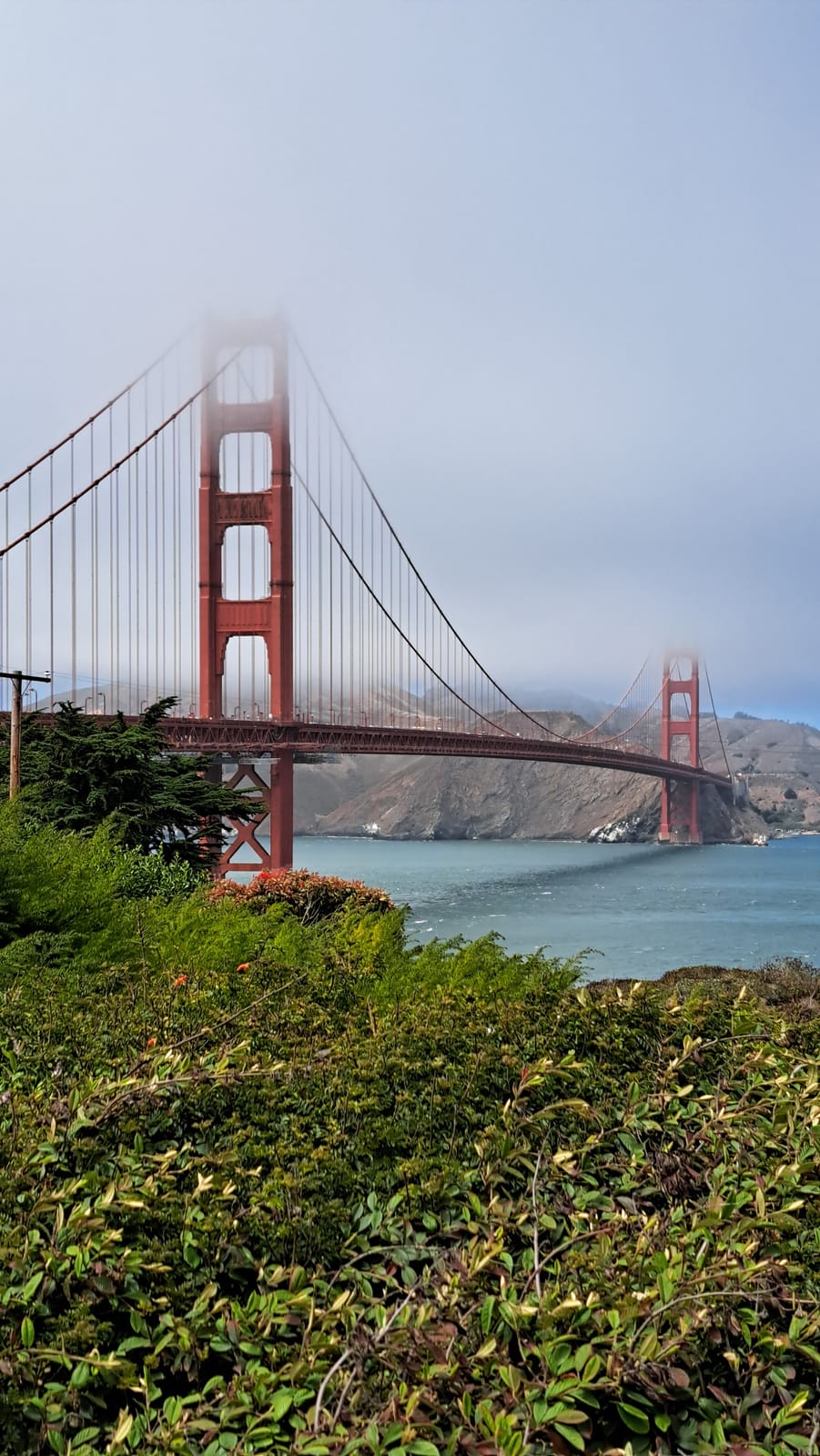
The day's other notable encounter came on the street rather than at a landmark: a self-driving taxi, something really remarkable for a tech addict who grew up watching "Knight Rider" on TV.
San Francisco to Mariposa Grove — Day 5
The morning brought rain, a stroke of luck in its own way given how clear the previous two days had been. We used it as an excuse to slow down, wandering through some of the city's less touristic corners with breakfast at a local bakery before returning to the car.
The drive east took most of the day. Sequoia National Park itself lay too far out of reach given the time available, so we set our sights instead on the Mariposa Grove of Giant Sequoias, at the southern edge of Yosemite — close enough to satisfy our daughters' wish to see the trees in person without reshaping the whole itinerary around it. The grove did not disappoint. Walking among trunks wide enough to walk through, some hollowed by fire yet still standing, still growing, gave a sense of scale that photographs never quite manage to convey.
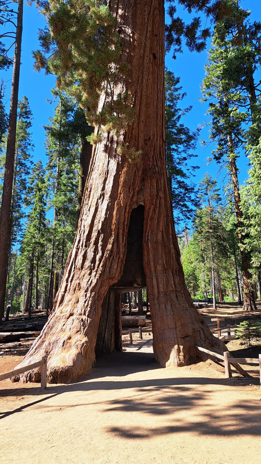
We spent the night nearby in Ahwahnee, a short and welcome rest before crossing into Yosemite proper the following day.
Crossing Yosemite, the Vernal Fall hike, and June Lake — Day 6
The route took us across Yosemite from the south entrance to the east, a truly stunning drive. The granite domes and sheer rock faces are undeniably striking, though for travelers accustomed to the Alps, the mountains themselves did not feel entirely extraordinary — impressive, certainly, but not the revelation the park's reputation might suggest.
The highlight of the day was a three-hour loop hike to Vernal Fall, taken via the Mist Trail. The reward at the top was a wide, open view across the valley.
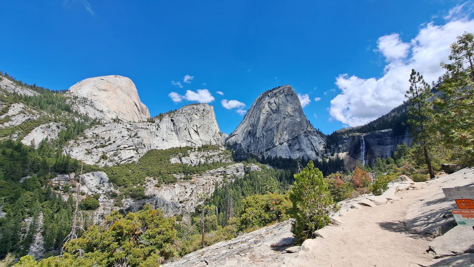
Yosemite left us with the sense that it rewards time rather than a single day's visit — the kind of place better suited to a week spent among its peaks, in the manner of a proper mountain holiday, than to a pass-through on a longer road trip. We continued east through the park and out the far side, spending the night by June Lake, just beyond the eastern entrance.
Alabama Hills and arrival in Death Valley — Day 7
The road south along the Sierra Nevada was a long one, the mountains holding to the west for most of the drive as the landscape below shifted gradually from alpine to arid. A stop at Alabama Hills broke up the journey. The rock formations there are eroded into rounded, improbable shapes, arches and boulders scattered across a plain with the Sierra rising sharply behind them — a setting familiar from countless films, though seeing it in person, under a punishing sun, made clear why the location has been used so often.
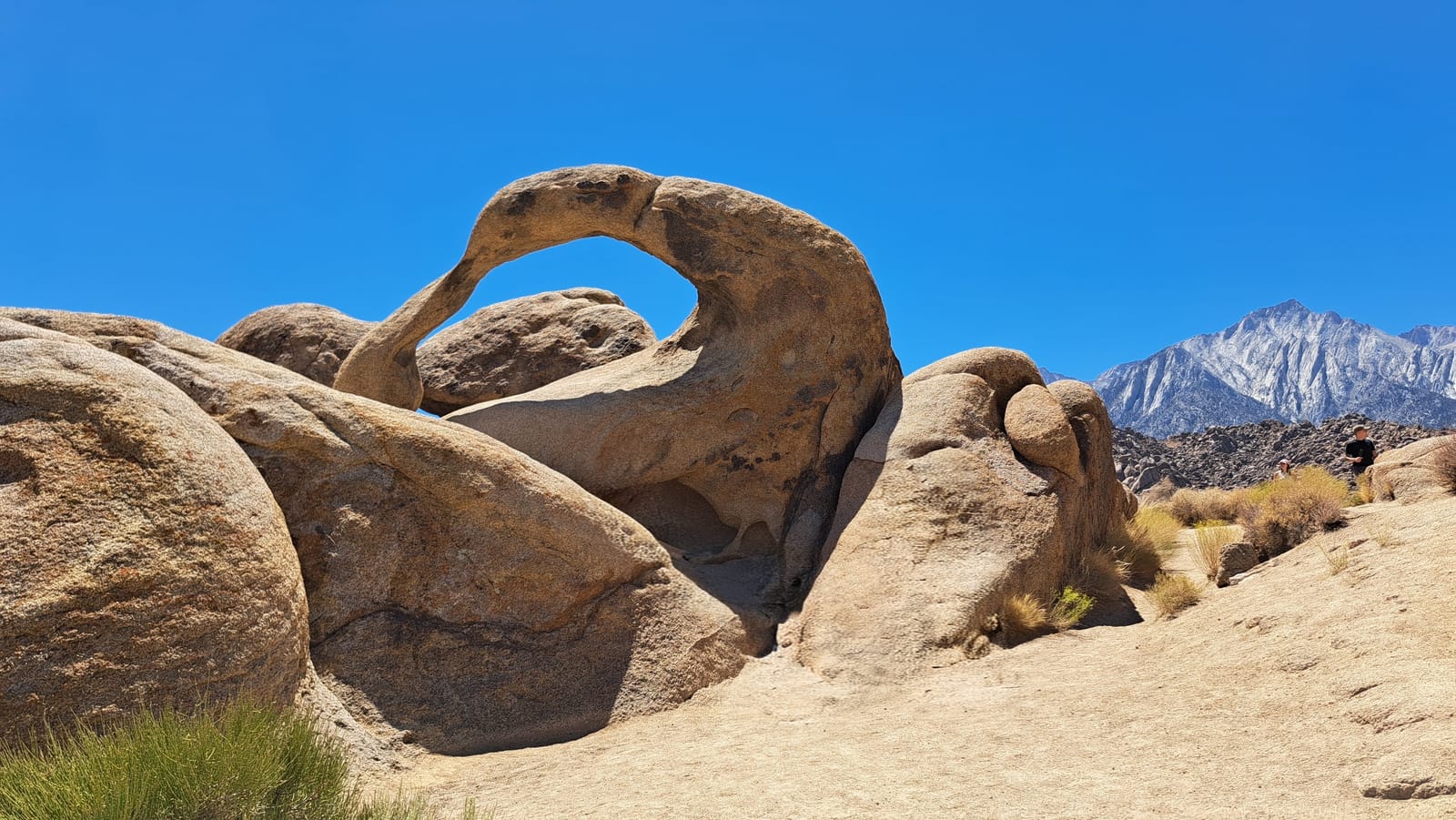
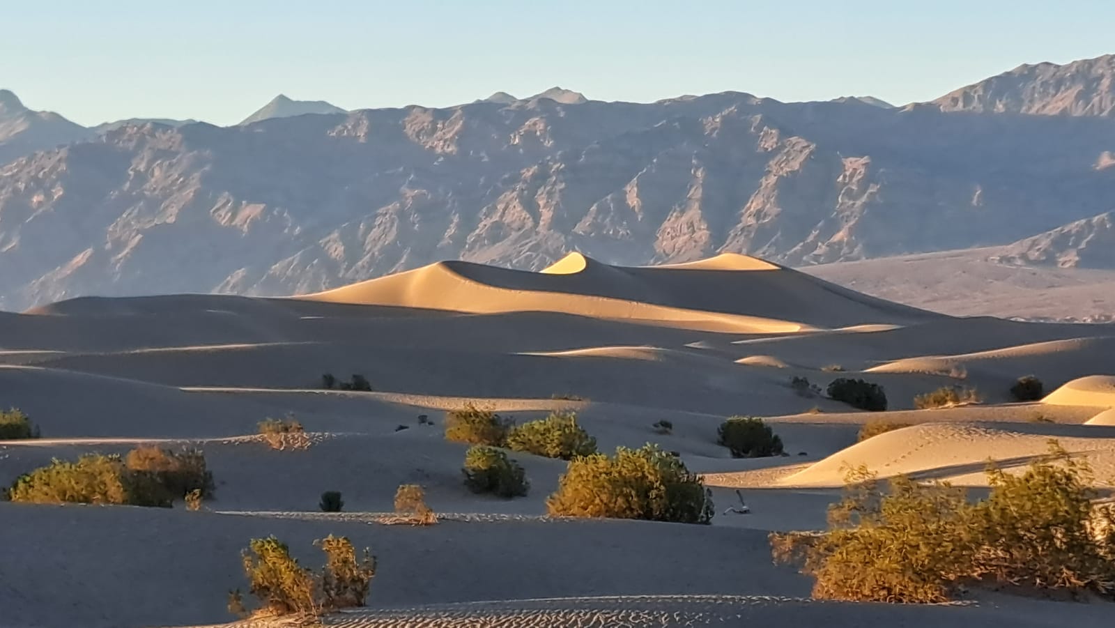
The heat only intensified from there. We reached Death Valley in the afternoon, with temperatures at 47 degrees Celsius — a figure that stops being an abstraction the moment you step out of the car. The reward came at sunset, at the Mesquite Flat Sand Dunes, where the last light picked out the curves of the dunes against the mountains in sharp relief.
Zabriskie Point, Badwater Basin, and the drive to Las Vegas — Day 8
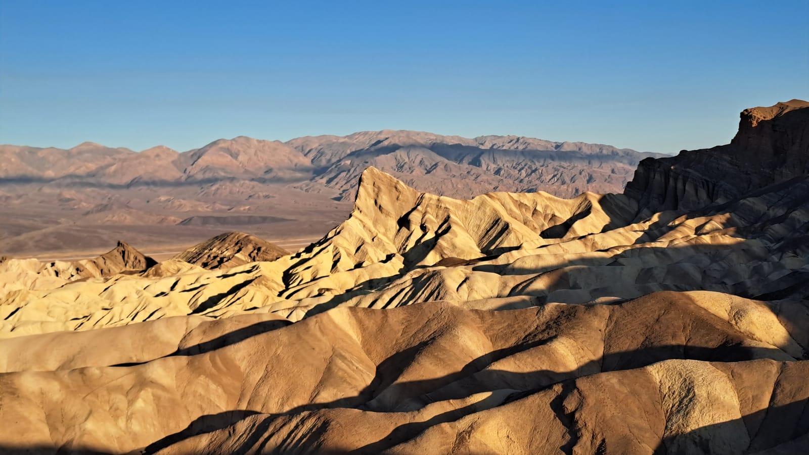
The alarm came early, well before dawn, for sunrise at Zabriskie Point. It was worth every lost minute of sleep. The badlands there fold into an intricate landscape of ridges and gullies, eroded into golden and ochre tones that shift by the second as the light strengthens, the Panamint Range holding the horizon in the distance. Few landscapes reward an early start as directly as this one does.
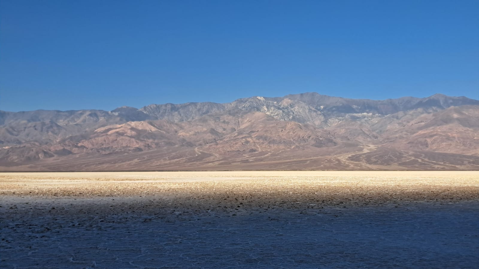
From there we moved on to Badwater Basin, timing the visit to catch the sunlight spreading across the salt flat before the heat became unbearable. The basin is the lowest point in North America, and the scale of it is disorienting — a flat white expanse running to the base of the mountains, the salt crust underfoot cracking into a mosaic that stretches farther than it seems it should.
We covered a few more of the park's iconic viewpoints before the late morning heat made further stops impractical, then turned east toward Las Vegas. The city was never more than a logistical stopover for us — after the scale and quiet of Death Valley, its density and noise felt like a lot to absorb. If anything, we found more genuine interest in the well-known pawn shop than in the Strip itself.
Zion National Park and the road to Kanab — Day 9
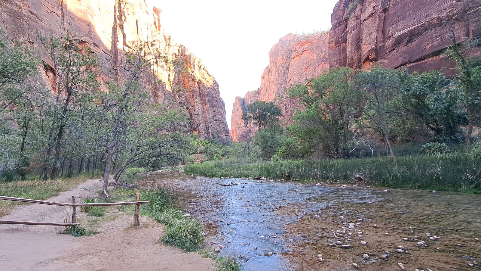
The route east from Las Vegas passed through Zion National Park, another destination that made clear how little a single day can do justice to these mountain landscapes. Zion rewards time and effort — long canyon hikes, the famous climbs among the narrows — none of which fit within a passing visit. What we could manage was a flat walk along the Virgin River, the canyon walls rising sheer on both sides in deep red sandstone, glowing where the late sun still caught the rock above the shadowed floor.
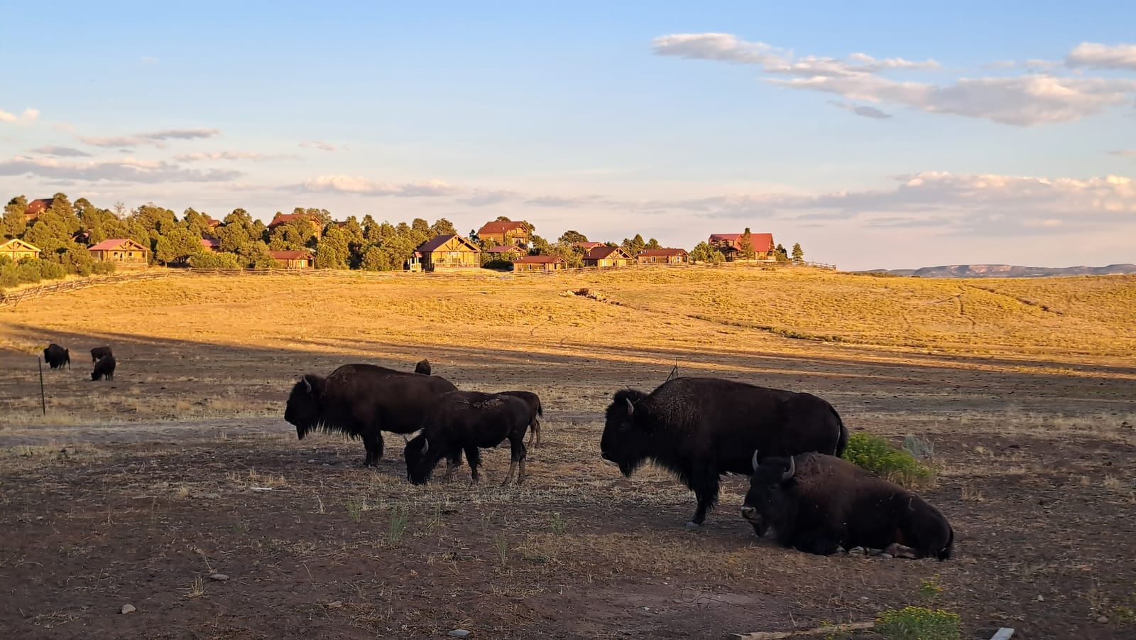
Later, on the road toward Kanab, we came across a herd of bison grazing in an open field, likely part of a local ranch, unconcerned by the passing traffic. It was an unexpected and fitting way to close the day — a genuine wildlife encounter at sunset, with no queue, no crowd, and no expectation of it at all.
Bryce Canyon — Day 10
The drive from Kanab was short, and Bryce Canyon turned out to be one of the finest stops of the entire trip. From the rim, the amphitheater opens into an almost overwhelming density of hoodoos — thousands of slender rock spires packed together, ranging in color from pale cream to deep orange, with a dark line of forest closing the horizon beyond them.
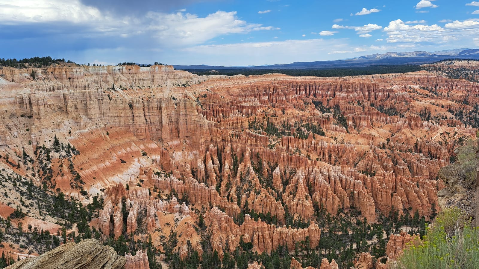
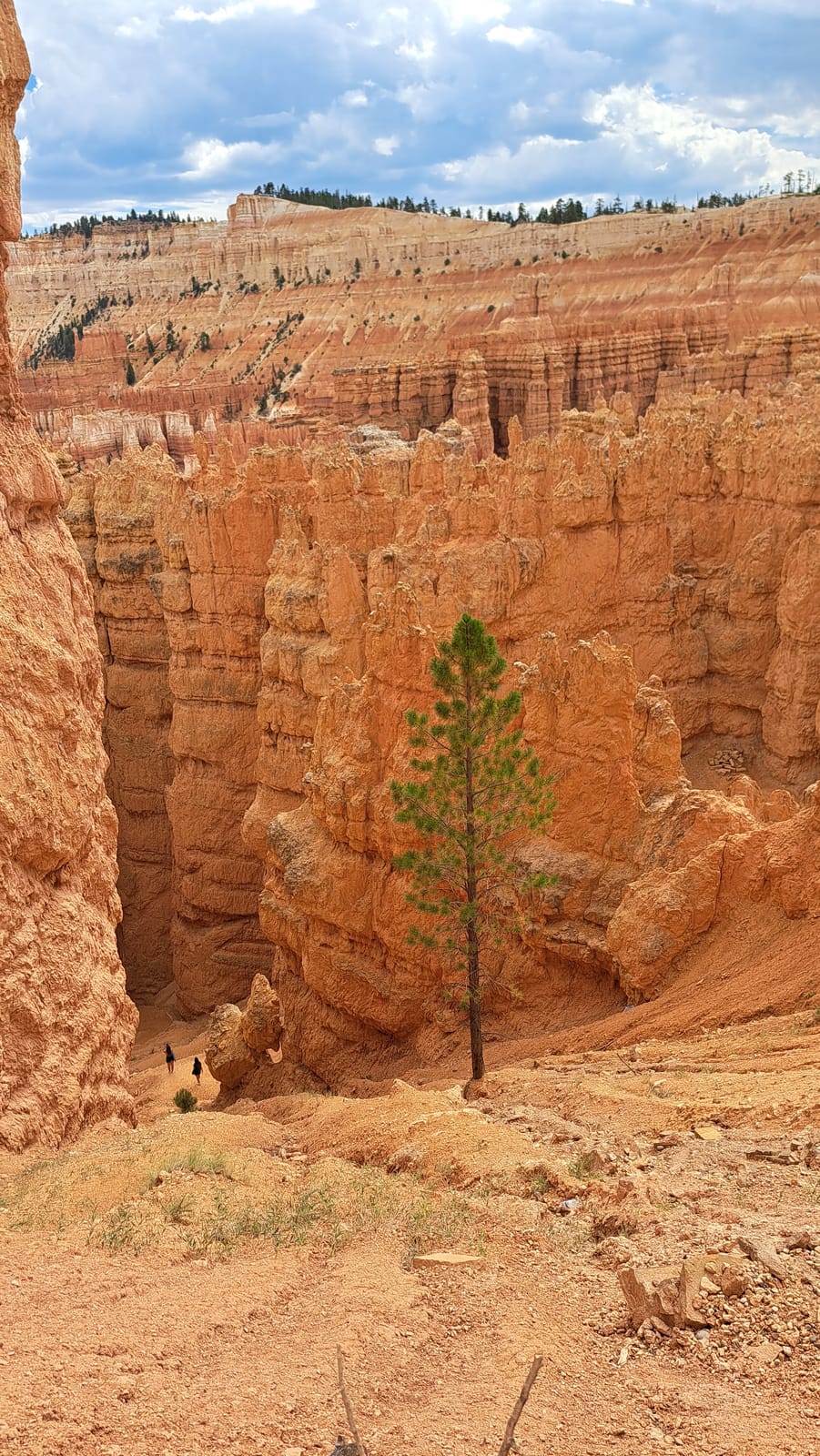
We worked through all the main viewpoints along the rim before dropping down into the amphitheater itself on a loop hike among the pinnacles. The scale shifts entirely once you're down among them: formations that read as texture from above become towering walls at close range.
Antelope Canyon, Horseshoe Bend, and Monument Valley — Day 11
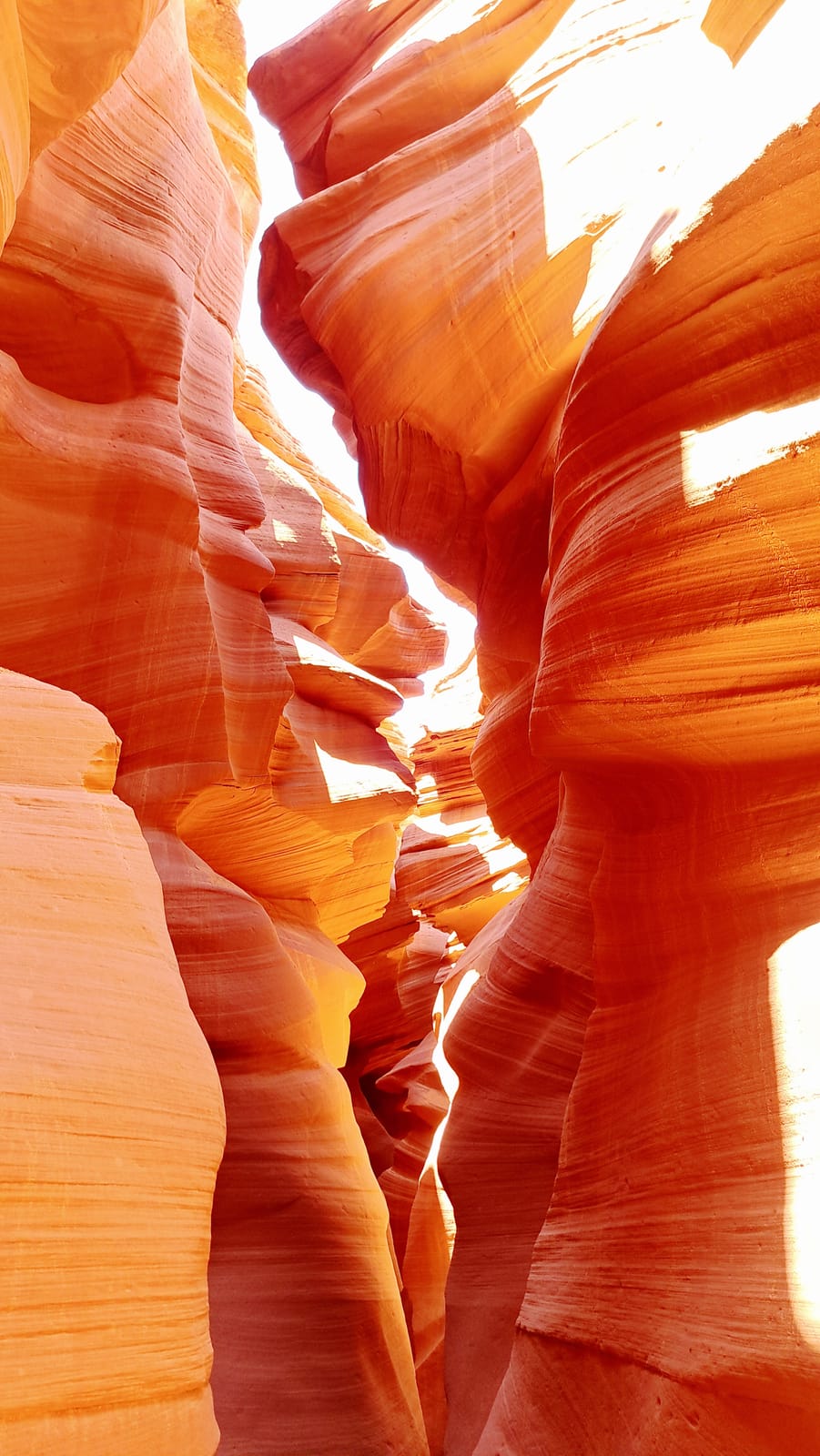
The morning began with a visit to Lower Antelope Canyon, and it stands out as one of the finest experiences of the entire trip. Walking through the slot canyon means moving between narrow, curving sandstone walls carved smooth by centuries of flash flooding, the rock rippling in bands of orange and deep red, with shafts of light dropping down from the narrow opening far above.
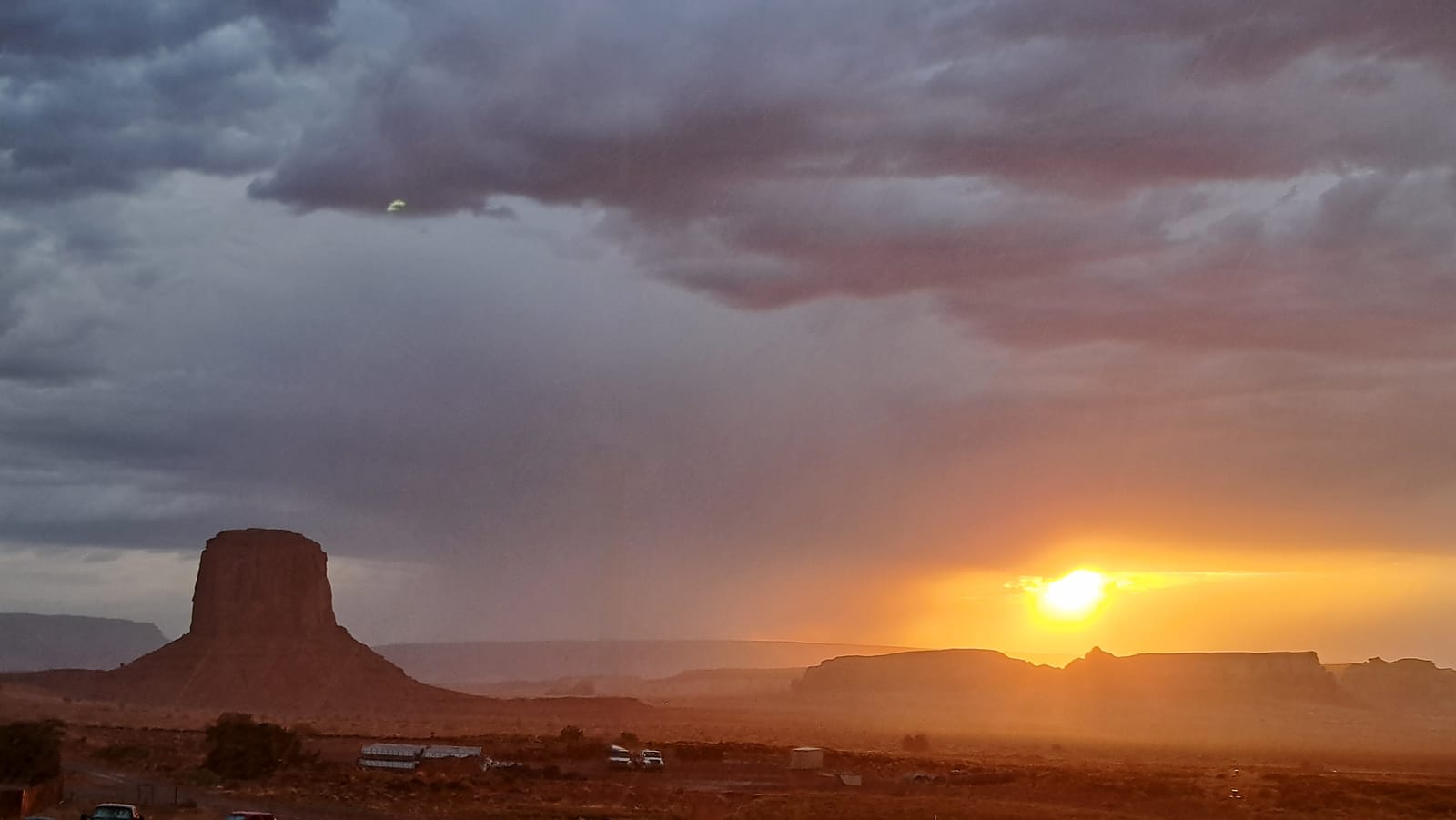
From there we made a brief stop at Horseshoe Bend, taking in the view before continuing on toward Monument Valley. We had booked a room at The View, and the panoramic outlook from there justified the cost entirely — the iconic buttes and mesas of the valley laid out directly in front of the room, changing character with every shift in the light.
Dinner brought an unexpected turn: a storm rolled in, a rare event in this part of the desert, and it produced some of the most striking images of the trip.
Sunrise over the Mittens, the Navajo-guided tour, and the drive to Williams — Day 12
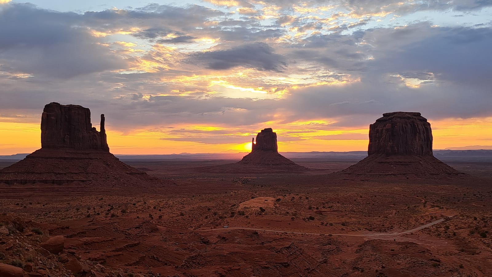
The alarm came early again, this time for sunrise behind the Mittens — the twin sandstone buttes that have become the defining image of Monument Valley. The wait was worth it: the sky shifted through layers of gold and pink behind broken cloud, the sun eventually breaking free just beside the formations and setting the whole valley alight.
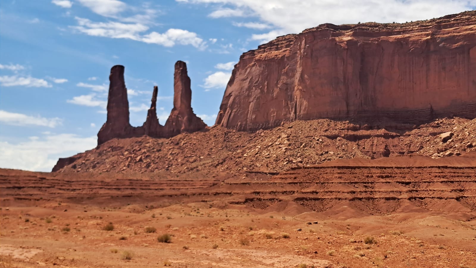
Afterward, we took a short hike at the base of the buttes before joining a Navajo-guided tour, which turned out to be one of the more rewarding organized activities of the trip. The guide brought us to viewpoints inaccessible without a permit, including a striking formation of slender rock spires rising beside one of the valley's great mesas — a perspective on the landscape that the standard loop road simply does not offer.
In the early afternoon we began the drive west, retracing part of our route back toward the Grand Canyon area, arriving in Williams by late afternoon.
Grand Canyon South Rim and Route 66 in Williams — Day 13
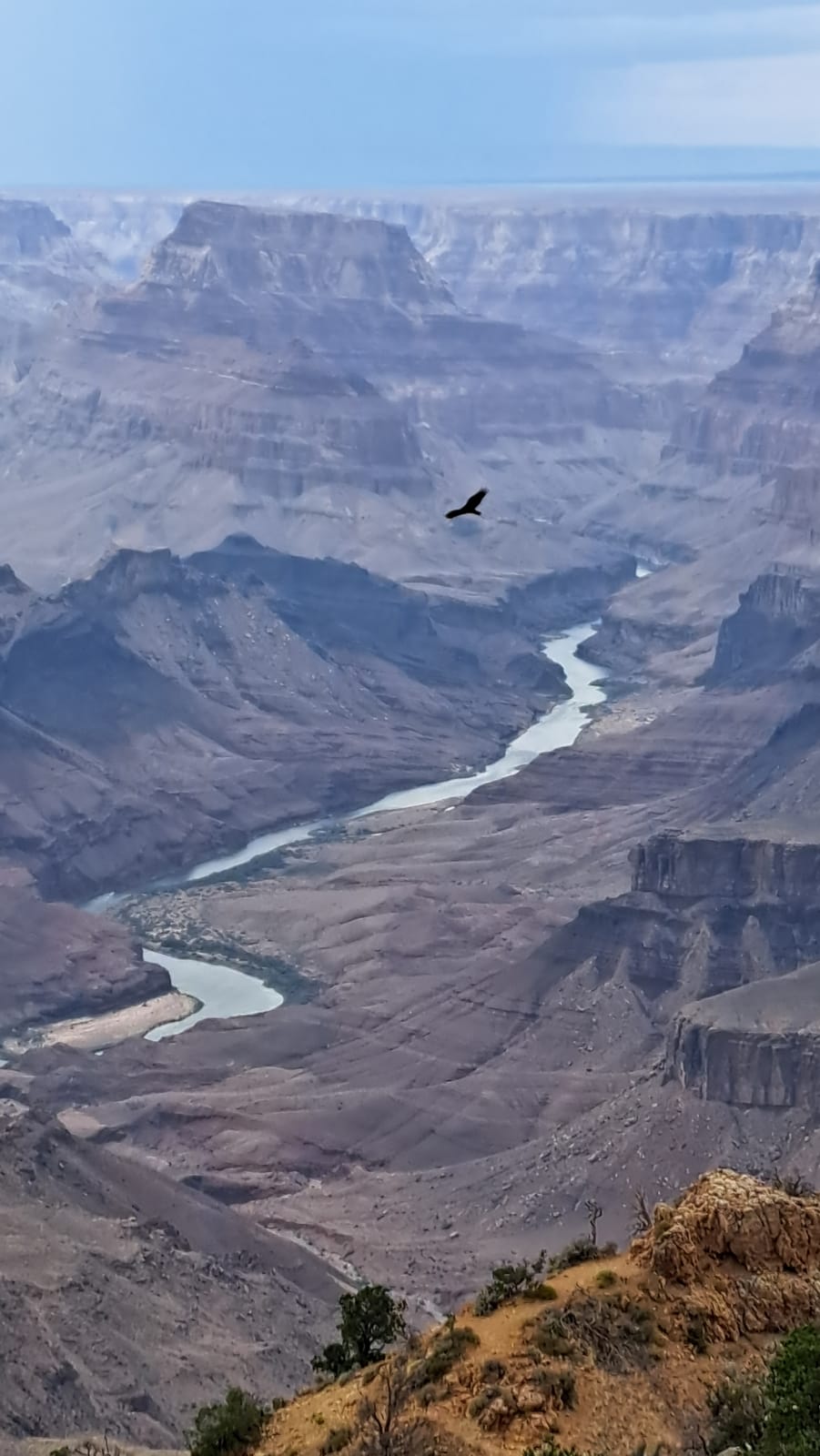
There is no easing into the Grand Canyon. Even after two weeks of increasingly dramatic landscapes, the scale of it registers as something categorically different — a chasm so vast that distance and depth stop being intuitive, and every viewpoint resets the sense of proportion all over again. We spent the full day working along the South Rim, moving from overlook to overlook, watching the canyon's colors and shadows shift as the light moved across it.
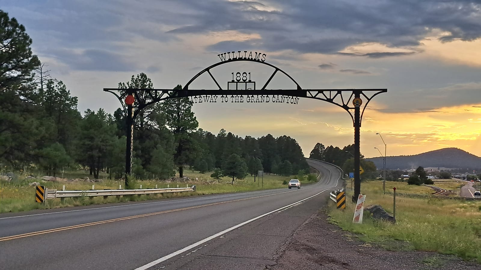
We returned to Williams for the evening, and gave ourselves over fully to the town's chosen identity as a Route 66 waypoint. Dinner was as touristic as it gets, and enjoyably so; after the immensity of the day, a small dose of kitsch felt entirely appropriate.
Joshua Tree, interrupted — Day 14
The plan for the day was straightforward: a visit to Joshua Tree National Park, one of the few stops on the itinerary chosen purely for its landscape rather than any particular activity. We were nearly at the entrance when a flash flood warning came through, urgent enough to change our plans on the spot.
Flash floods in desert terrain are not a risk to take lightly. The same dry washes that carry nothing for most of the year can fill within minutes during a storm, turning roads impassable and low-lying areas dangerous with little warning. Rather than push ahead and risk being caught inside the park, we turned back without crossing into it, forgoing the visit entirely.
The rest of the day became a more direct drive than planned, heading to Palm Springs to spend the night safely away from the affected area. It was a frustrating way to lose a day this late in the trip, but the decision made itself: no landscape, however anticipated, was worth the risk the warning implied.
Return to Los Angeles: Walk of Fame, Hollywood, and Santa Monica Pier — Day 15
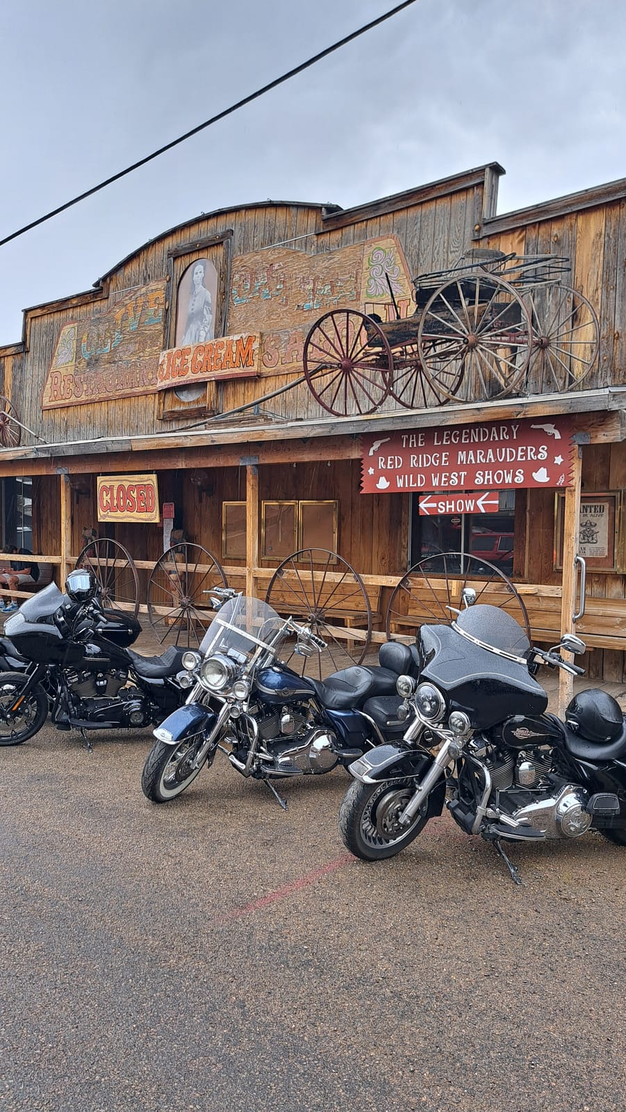
The last stretch of road ran back toward Los Angeles, retracing pieces of the old Route 66 corridor. Along the way, a deliberate detour took us to Oatman — an old mining town turned roadside attraction, and a genuinely strange place to pass through. Donkeys wander freely down the main street, weaving between visitors and parked motorcycles as if the town still belonged to them. Whether Oatman counts as a preserved ghost town or a well-run tourist trap is not entirely clear, and possibly it is both at once.
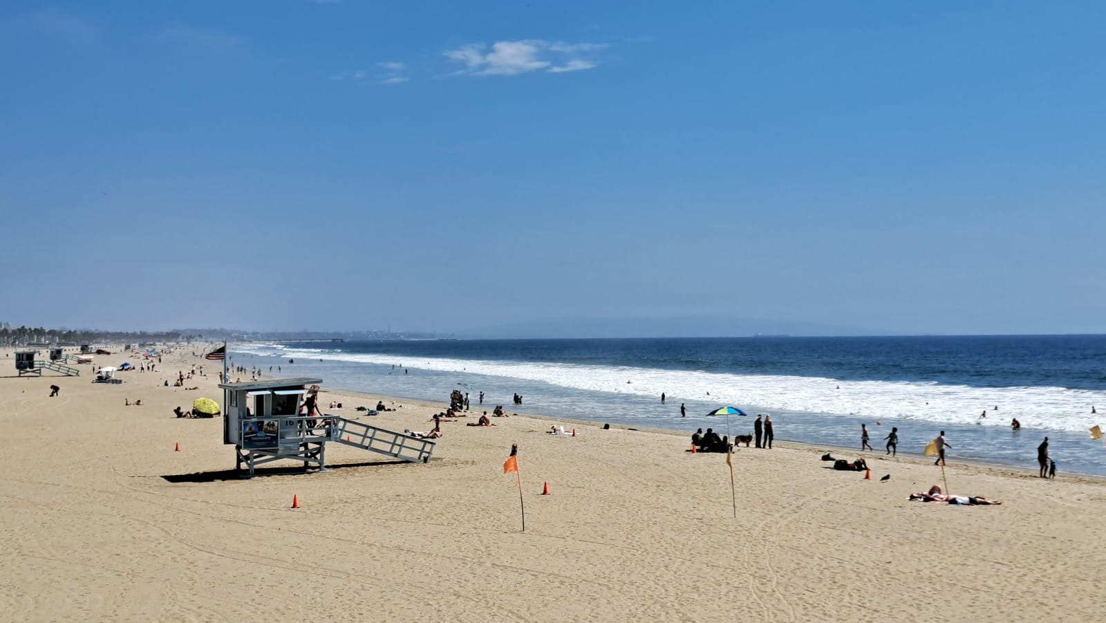
Back in the city, we allotted just enough time before the airport for a last round of the obligatory stops. The Walk of Fame proved to be the least rewarding of the three — more crowded sidewalk than spectacle, and easy to skip on a future visit. A quick photo beneath the Hollywood sign fared better, delivering the expected postcard shot without much effort required. The real closing note came at Santa Monica Pier, marking both the end of Route 66 and the end of our own journey — wide sand, a proper Pacific swell, and the unmistakable feeling of a trip winding down exactly where it should.
From there it was a short drive to the airport, and home.
The rock rippling in bands of orange and deep red, with shafts of light dropping down from the narrow opening far above.
Fifteen days and roughly the length of a continent later, the trip closed the way it had opened — on a Los Angeles beach, with an airport not far off. Between those two points sat a stretch of country that earns its reputation honestly: coastline, sequoia forest, salt flat, slot canyon, and mesa, each one distinct enough that no single image could stand in for the whole.
This is a landscape that has been photographed, filmed, and mythologized for a century, and it still delivers when you go looking for it in person. What stayed with us most, though, had less to do with any single landmark than with the small, unscripted moments along the way — a herd of bison beside an empty road, a storm breaking over Monument Valley at dinner, a condor drifting over the Grand Canyon. The itinerary provided the structure. Those moments provided the trip.